 |
| Cruising on the middle Rhine with its castles and vineyards. |
 |
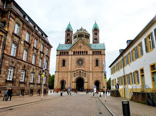
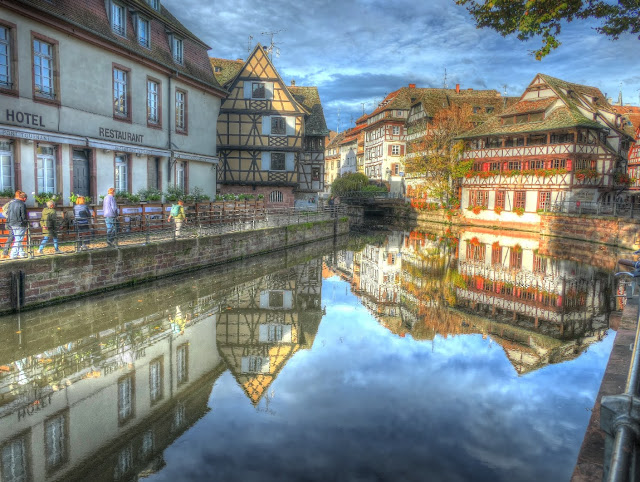
| Just arrived |
On October 18 we left Rochester for Basel Switzerland to begin twelve days cruising on the Rhine River to Amsterdam, Netherlands. We returned on October 30 after a wonderful time jammed packed with scenery, history, food, wine and beer. In fact, I have a five-pound souvenir of the trip which I hope will not be permanent. In addition, I also returned with COVID-19. I felt symptomatic on the way home and immediately took a test which came back negative. When things had not improved the next morning, I took another and realized I was positive. Fortunately Marilyn is still negative. I have been spending most of my time in the area downstairs processing and curating photos.
I am feeling much better and have begun to document our trip. So, get ready, this will be the first of several blogs. Before I get into our daily adventures, I want to share some information about the river that the Germans call Father Rhine, about the cruise line and about the history that has unfolded along our route.
The Rhine
 |
By Ulamm - File:Rhein-Karte.png by
Daniel Ullrich. Wikipedia |
The Rhine begins in the Swiss Alps and inflows into Lake Constance and then to Basel where it turns north. The overall length is 765 miles making it the second longest European river after the Danube. Only the 530 miles from Basel to the North Sea is navigable for commercial traffic. The map shows the regions of the Rhine. The purple, dark blue and light blue show the Alpine and High Rhine areas. Beginning at Basel, the green shows the Upper Rhine, the yellow the Middle, the orange the Lower and the apricot the Delta Rhine. Today 60 million people live in the Rhine catchment area making it by far one of the most important rivers in terms of its impact, positive and negative, on humans and the environment.
All rivers are important to human existence because of their singular characteristic, moving water. Lakes are also sources of water which is essential to human life and agriculture, but lakes are typically still water. Rivers move water and that means they store energy. My hometown of Rochester was founded on the Genese River even though a nearby Great Lake had plenty of water. The Genesee which empties into Lake Ontario loses altitude as it nears the lake, and that loss of altitude means the water moves rapidly through waterfalls. This perpetual source of energy could be captured by mills in a way that the water in a lake could not be. So water and power drew people to the Rhine. The High Rhine eventually would provide hydroelectric power because of the water losing altitude. But eventually dams would be used to store water that would then pass through hydro stations. In the 20th Century power plants fueled by coal, oil, gas and then nuclear would be built along the Rhine. Those plants all used combustion or nuclear reactions to turn water into steam which would drive turbines which would turn generators. They were situated along the Rhine because the plants needed continuous supplies of water to cool and condense the steam back to water which would then be reheated to steam and so on.
But rivers also provide transportation. People knew that rivers provided more efficient methods of getting themselves and their goods from point A to point B. For the earliest inhabitants this was not all that critical. Their trading partners were regional. However, the earth began to get smaller in the 16th century. Trade was becoming international. Plus the population along the Rhine was increasing and it was seen as a highway for transportation of those goods, both raw materials and finished goods. By the beginning of the 19th century steamships were available for navigation for the entire length of the river up to Basel. In 1813 the states along the Rhine formed the Rhine Commission and empowered it to manage the river to improve navigation and reduce the frequency of floods and thus their economic disruption. The objective was economic development. This meant that the Rhine could not be left in its natural condition.
The Upper Rhine from Basel to Wiesbaden runs through the Rhine Rift Valley. This valley extends for 220 miles and is 30 miles wide between the Black Forest on the east and Vosges mountains on the west. For those familiar with rivers and their flood plains in the Midwest, it is a familiar story. The river meanders through its valley and often changes course as spring floods create new channels and marsh lands. It is a compelling natural landscape but a transportation nightmare. To improve the economics of the river, the Rhine Commission undertook what it called "rectification" programs.
The graphic to the left shows the impact over time. The top third shows the "natural state" in 1825 and the bottom two show the impact of rectification over the next hundred years. The result was a canalized river with levees keeping the channel in one location and reducing flooding. This regularization also reduced the length of the river by eliminating bends and curves. This shortening and deepening of the channel resulted in water moving more rapidly downstream rather than lingering in wetlands. All this completely changed the ecosystem of the river and the valley with major loss of plant and animal species. What had functioned as a 220 by 30 mile sponge became a concrete sluiceway.
While the floods on the Upper Rhine declined, those in the Middle and Lower Rhine increased in frequency and severity. The planner had not understood that the Upper Rhine had functioned as a giant retention pond releasing the spring mountain melt off gradually downstream rather than speeding it on its way. To protect the agricultural and manufacturing downstream, the Commission gradually came to manage the entire river through dams, locks and impoundments. So today when we cruise on the Rhine, we are not experiencing the Rhine of the 19th Century because it no longer exists.
Rivers are also important because manufacturing requires both power and water. The Ruhr Valley continues to be a major heavy industrial area in Germany and the Ruhr is a major tributary to the Rhine. In addition, Germany's world leading chemical and pharmaceutical companies are located on the Rhine. Rivers are used by humans as sewers to cleanse and carry off their waste. The Rhine is big river and until modern times it was able to accomplish this. The Rhine Commission was not charged with managing the quality of the Rhine. All that changed in the 1970's when activists and scientists discovered that parts of the Rhine were effectively devoid of oxygen and filled with deadly chemicals. Other parts were in the process of dying. That has changed for the Rhine as it has for rivers in the United States.
Even before all this, the Delta Rhine in the Netherlands had been managed by the government in its "War on Water" which I will write about when we come to the end of the cruise.
Viking River Cruises
We sailed on the Viking Longship Mani with 188 other guests and a crew of fifty. It is 450 fee long and was built in 2014. The Mani's captain is Amber de Nooijer That's right, Amber. She is the only female captain in the fleet. When that fact was announced during her introduction, she received a round of applause. She is in her late twenties and began working for Viking as a sailor on a river longboat.
We sound like everyone we know after their first Viking trip. We highly recommend Viking. Everything was handled expertly. We had added two days at the beginning and two at the end of the cruise through Viking. They handled all the flight and hotel arrangements including transfers to and from hotels and the ships. The food was excellent, not at all like the normal cruise fare we have had on our couple of Carribean cruises.
This was not a leisurely cruise. With one exception, the cruising was done overnight. Every morning we were in a new port with a scheduled two-hour walking tour of the city. There were optional excursions and we signed up for three of those. In total we walked 73.5 miles or a little less than seven miles per day. Still, I gained weight. Well as I said the food and beverages were excellent and constantly available.
History
It has been a long time since I read European history but much of it came back as we visited cities many of which have been in existence for a thousand or more years. The religious history of the Reformation is everywhere as well as the history of Germany as it struggled to become a single nation. World War II and the post war history are unavoidable. The local guides wove current and historical topics into our experience. We had no trouble hearing them since each of us received a personal listening device that was connected to the guide's headset. Their English was as excellent as their sense of humor.
That's it for the preliminaries. I will now be working on first few days and will send that blog along when completed.


Bill, Great History about the Rhine, etc. Several years ago we went on a cruise from Amsterdam to Vienna. The Rhine River was part of the cruise. Awesome.
ReplyDeleteWow, thanks for an information intro to the Rhine River! I loved it. I wonder if much of the wildlife has come back ? We plan to go in Oct 2023 and I will look for wildlife. Look forward to readin gmore of your posts.
ReplyDelete